

In the Footsteps of Wheeler & Campbell:
Repeat Photography in the Campbell Icefield
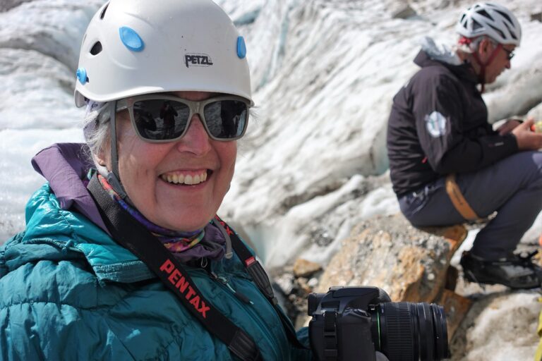
By Mary Sanseverino for the 2025 ACC Gazette
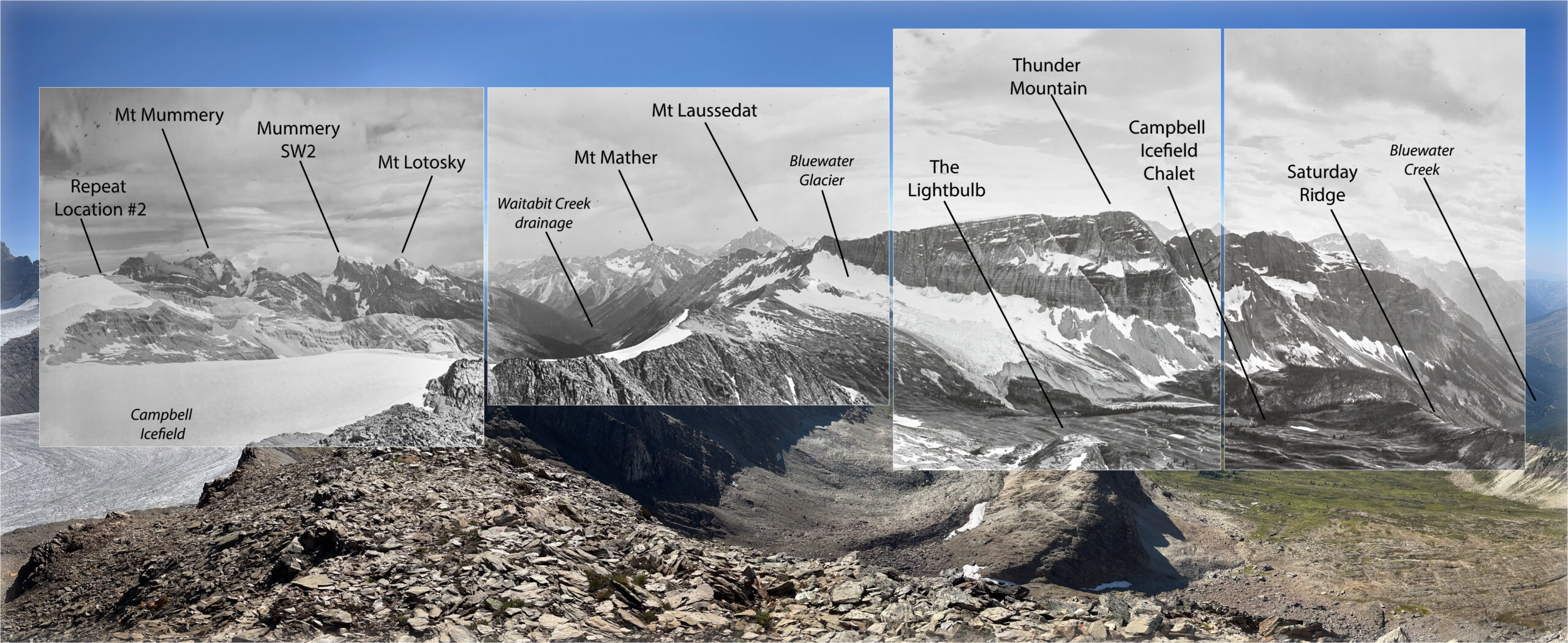
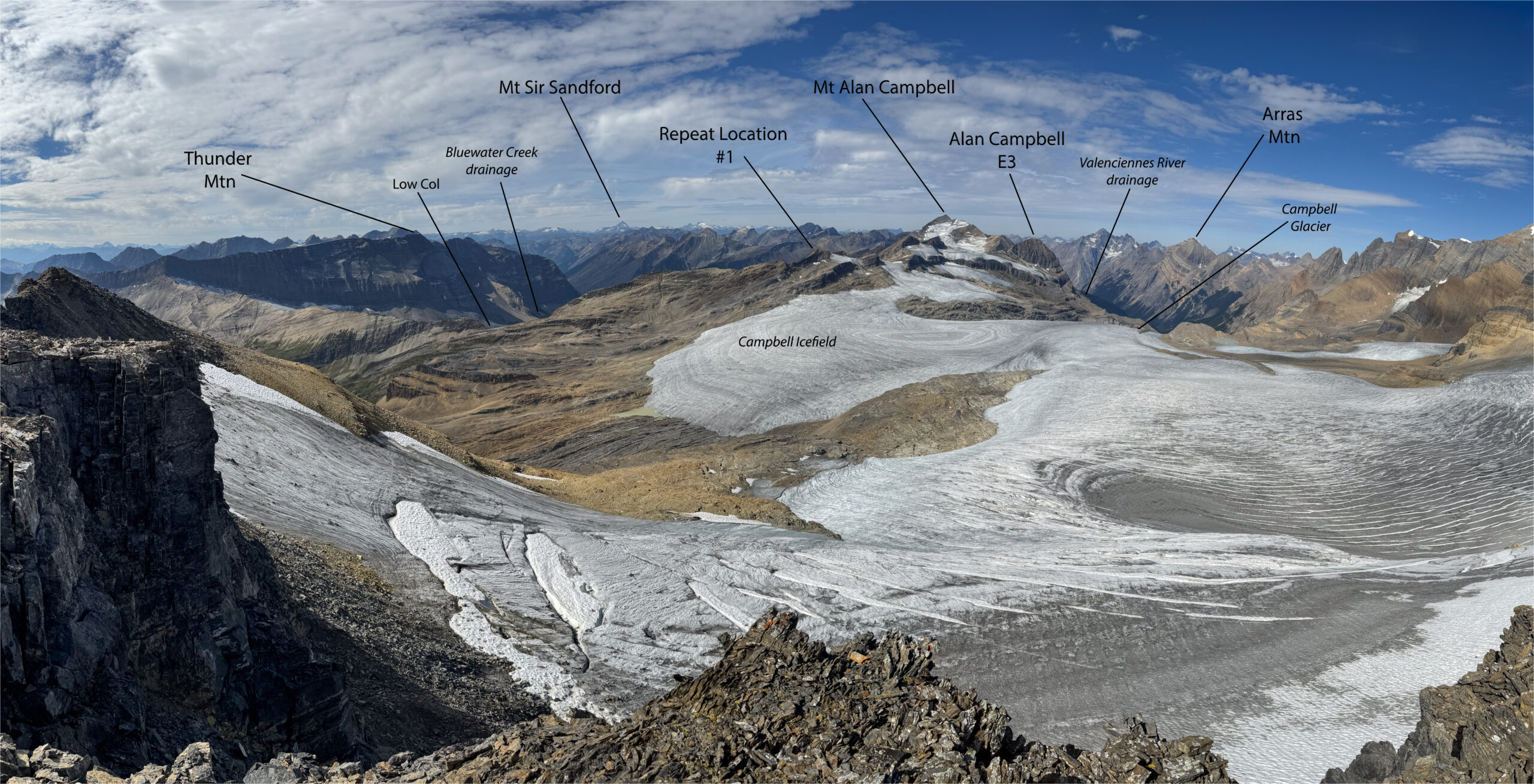
On July 18, 1918, surveyors Arthur Oliver Wheeler and Alan John Campbell, along with assistant Lee Grant Cameron rose early and ventured up the northern arm of what would later be called the Campbell Glacier and Icefield. Their goal was a high point midway along the western ridge above the ice. This, along with another point on the southeast of the icefield, afforded them exceptional views of the entire area. The black and white inset photos presented in this article capture a sense of what it must have been like for them.
The First World War still raged in Europe but Wheeler and Campbell, working with a reduced and inexperienced crew, were here to map the official inter-provincial boundary between BC and Alberta. Using a combination of traditional survey methods (measuring horizontal and vertical angles between specific points) and photography, their goal was to create topographic maps of the border.
It was an exciting moment when, on September 7th, 2024, I, along with a team of climbers from the Vancouver Island Section, was able to stand where Wheeler, Campbell, and Cameron stood 106 years ago and repeat their images.
Looking at the historic/modern photo pairs here I think you’ll agree that much has remained the same. But even more has changed in the intervening years, especially with respect to climate-driven ice loss.
Mountain photography has been a passion of mine for many decades. I’m always looking for ways to let the photographs speak. So, I encourage you to spend some time with the images in this essay, perhaps reflecting on the dynamics behind the changes so evident in these images.
I struggle with the climate change contradiction that long distance driving, staging via helicopter, and air travel presents. But at the same time, I feel we mountaineers are in a unique position to bring the stories these glaciers tell to the world. At the very least, perhaps our words and images can help people better understand what is at stake in our rapidly warming world.
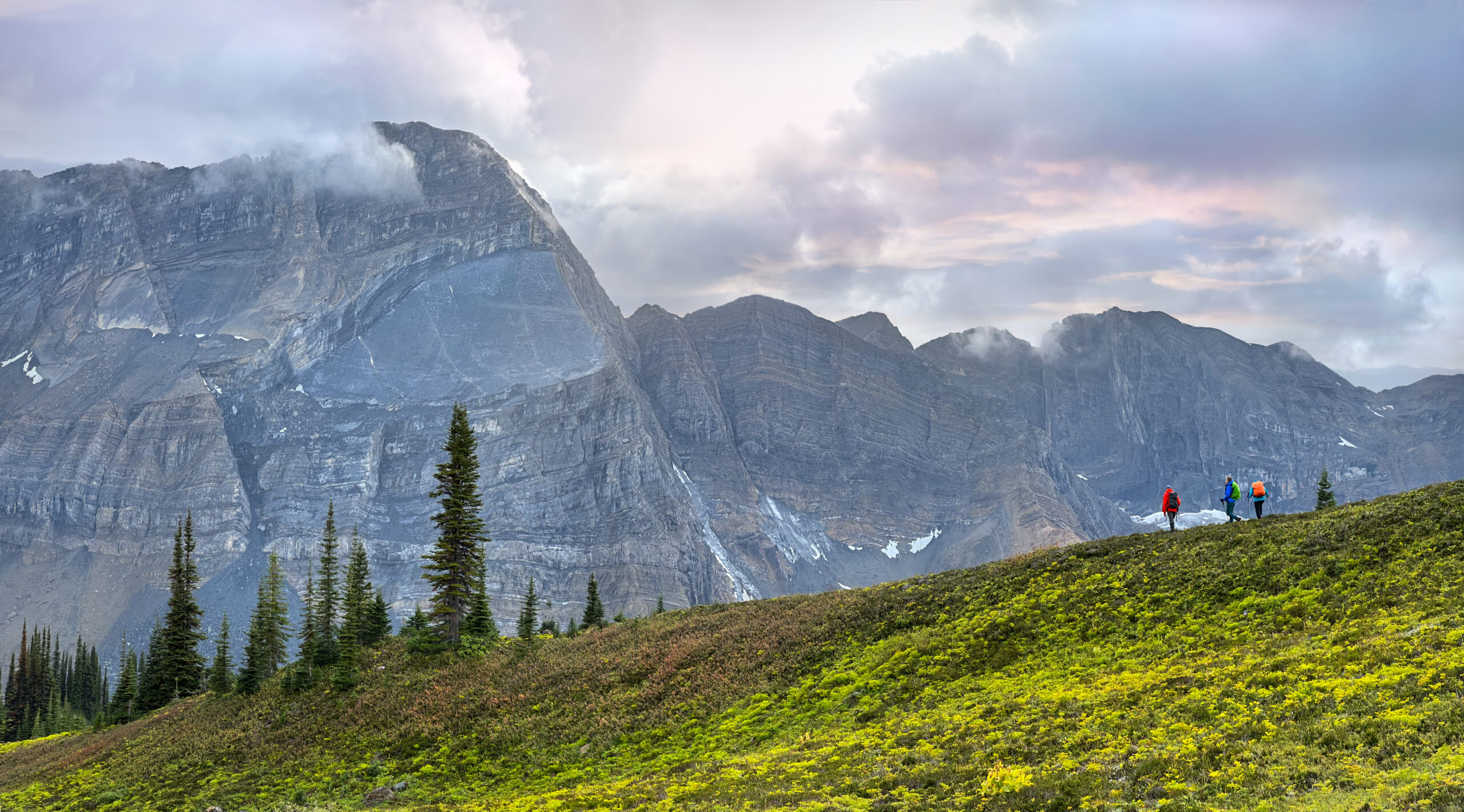
The access to both repeat photo locations – aka the “photo stations” – is via the Low Col. Starting out just before 7:00 am, I along with Yvonne Blum, Eva Gnech, Sylvia Moser, Sandy Stewart, Rachel Treloar, and Mike Whitney made our way over the col and then headed northward along the ridge to our left.
Diamond Peak is the local name of the high point we were making for. Photo location #1 was on top. The way up was straightforward with some interesting route finding, especially over the last 150 metres (thank you Sylvia!) to gain the summit itself.
We were, however, a bit more pressed to find a workable route off the mountain. We didn’t want to retrace our steps (the tarn in the bowl below was calling), so we picked our way down the southeast face of Diamond Peak. There were a handful of difficult Class 4 scrambling moves, but with everyone working together we made it without incident – although I may have uttered some distinctly un-mountaineer-like phrases at a few of the crappier rubble-on-slab passages. The tarn was especially refreshing that day!
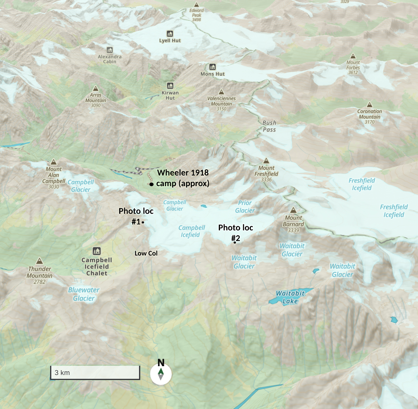
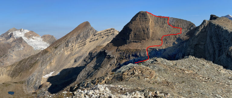
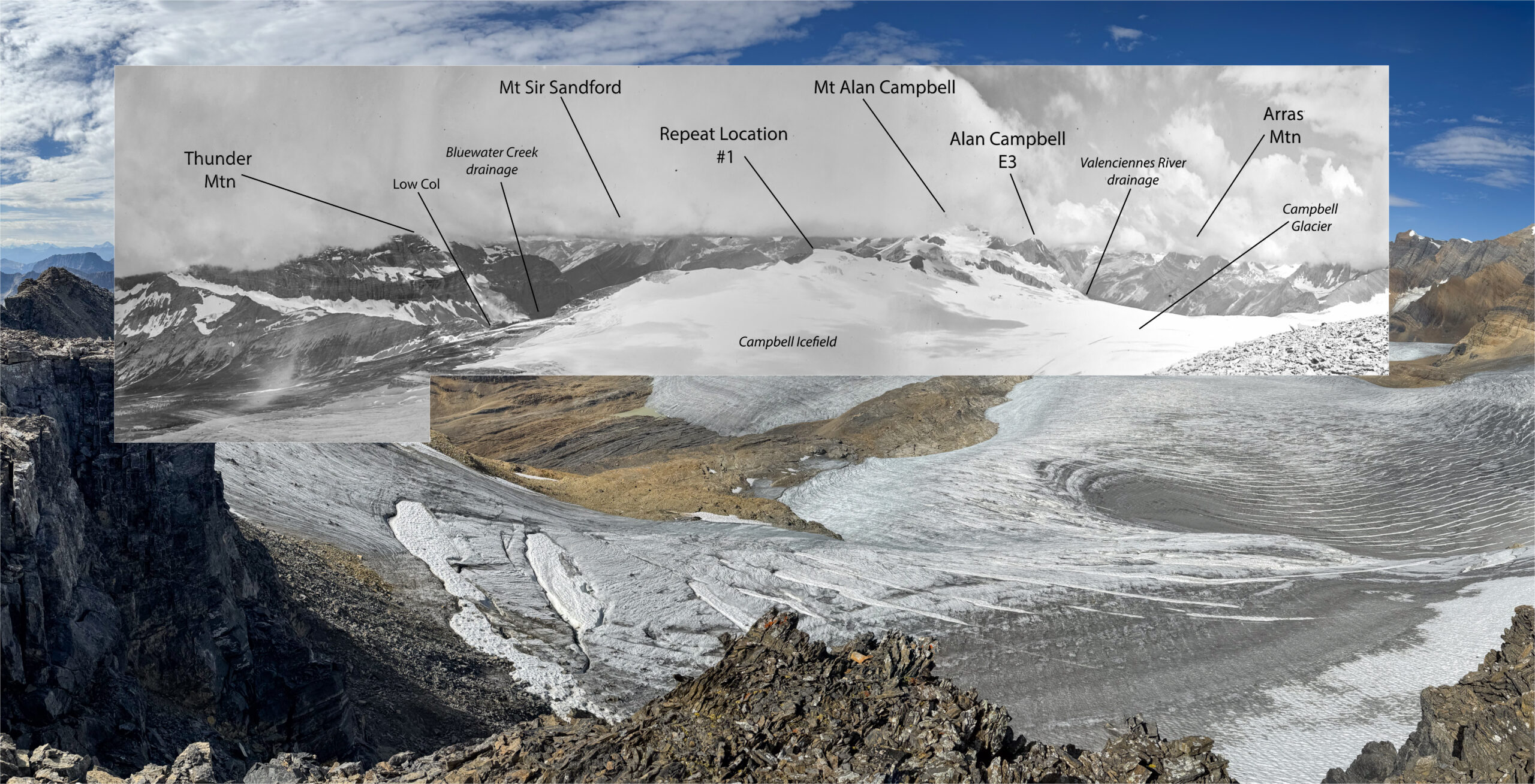
Photo station #1 - September 7th 2024
It was easy to find the remnants of Wheeler’s 1918 cairn on the summit and from that vantage point not difficult to line up and repeat the photos. The geology was very much the same, but the glacial differences were astounding. The images say it all – much more effectively than I can.
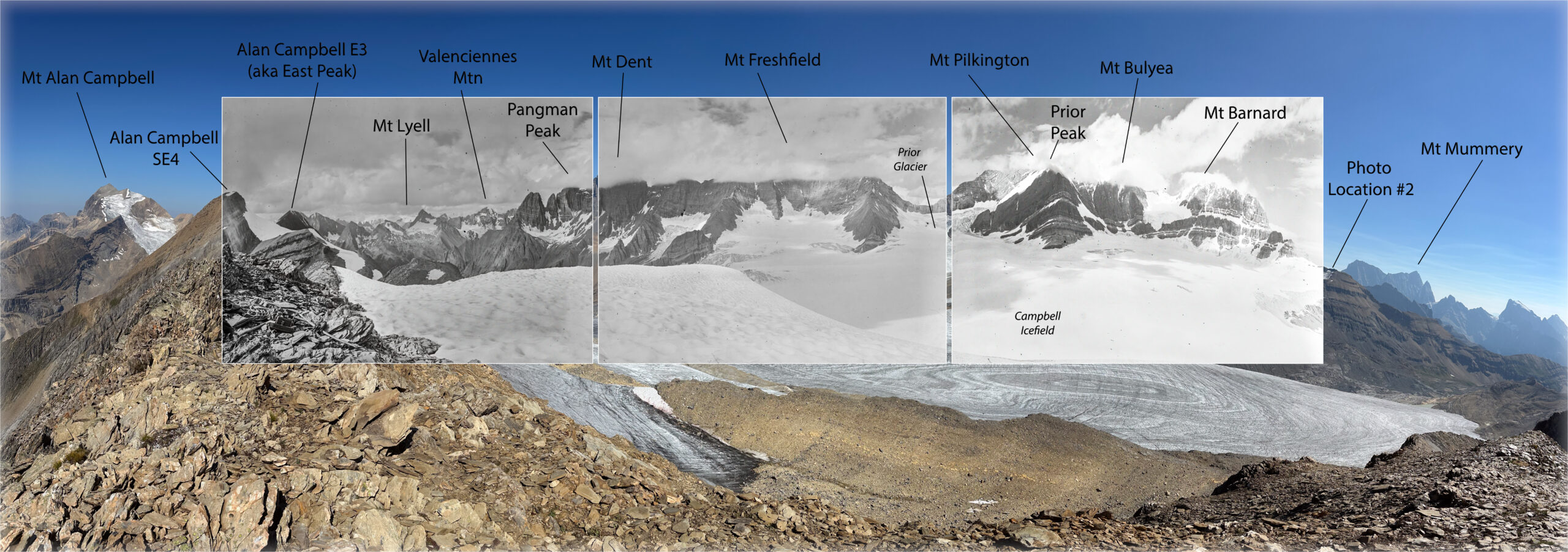
Photo station #2 - September 10th 2024
On Sept 10th a dozen of us started off for a day of exploration on the Campbell Icefield. Using the Low Col we accessed the moraine below the southwest lobe of the icefield. Another 1918 photo station was within striking distance on the lower portion of a shoulder below Mt. Barnard and several of our party were keen to try and get more repeat photos. While I did a low-level traverse of the icefield, others tried to find their way up high enough to get workable repeats.
In the end, Sandy Stewart and Sylvia Moser ended up gaining the top of the shoulder via an ever-steepening ice ramp. With only a quick look at the photos to guide him, Sandy stationed himself on the highest point available and took a series of images much as Campbell and company would have. The location was not quite the same, but the image comparisons still tell a deeply compelling story.
Meanwhile, back in 1918, it was late July and Campbell was in charge of the field crew. Wheeler had left to attend the ACC’s General Mountaineering Camp in Paradise Valley near Lake Louise. Fun fact: Wheeler always made it a contract condition that he be allowed to leave field work so he could attend the GMC.
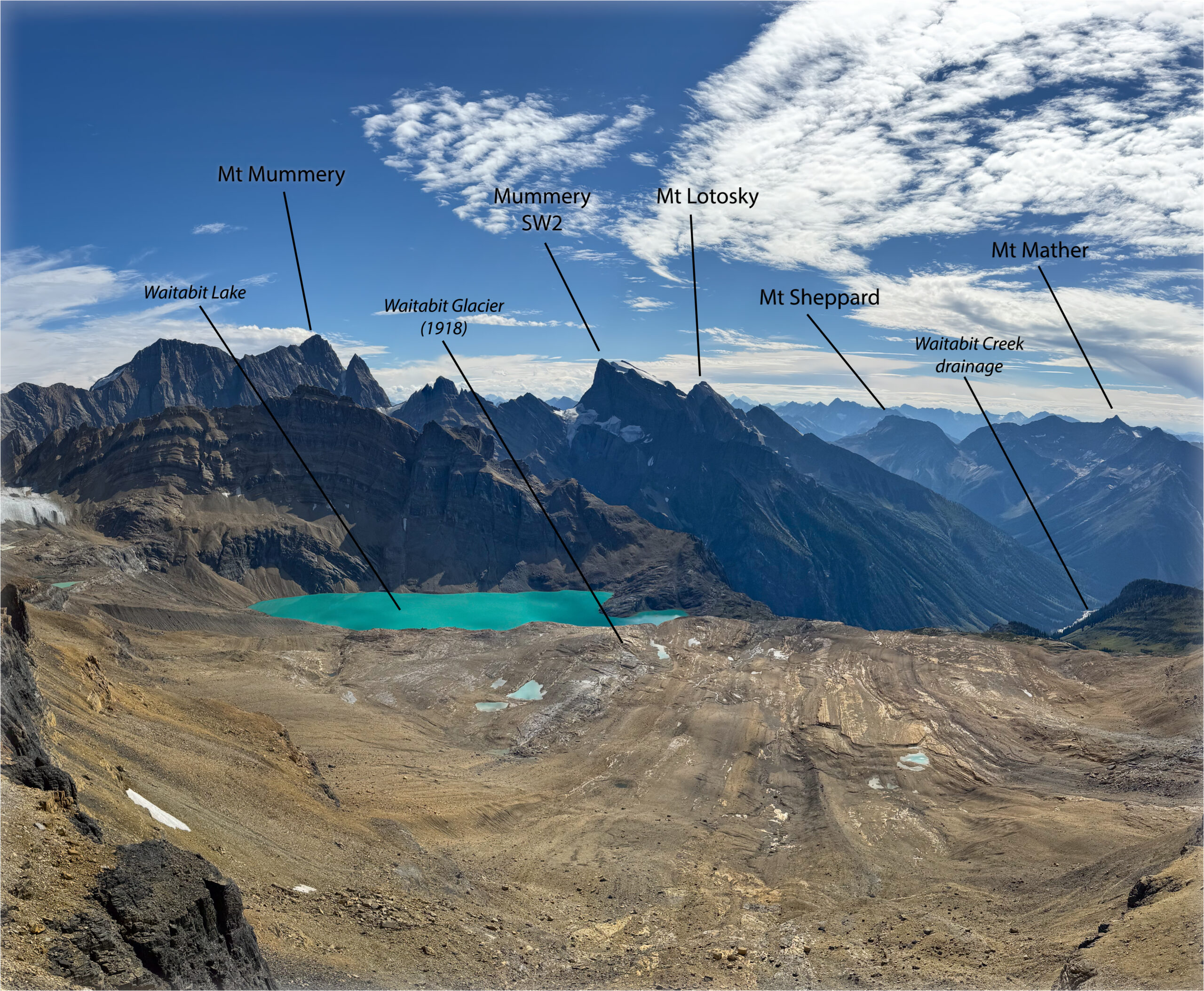
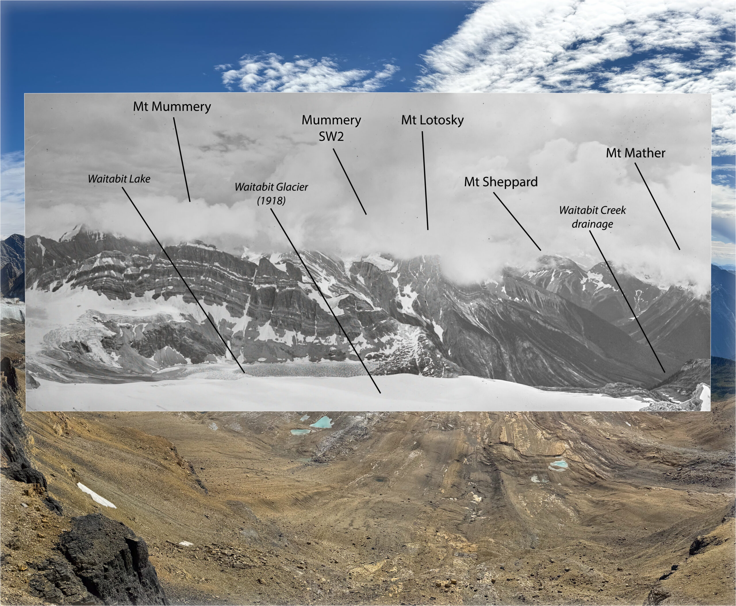
Looking southeast, the historic/modern images from this vantage point show Waitabit Glacier (what remains in 2024) and Lake. They form part of the Waitabit Creek drainage, which joins the Columbia River at a shallow angle just outside of Donald, BC. It’s called Waitabit because back before the Mica Dam tamed the mighty Columbia River, canoe travellers used to pause here, adjust their loads, and check their craft before travelling on downstream around the turbulent Big Bend [2]. Just another example of how interconnected our alpine environments can be with the lower elevations. The idea that a snowflake can fall up high in a place like the Campbell Icefield and end up in the Pacific Ocean never ceases to amaze me.
Thank you to all of the Campbell Icefield ACCVI team: Yvonne Blum, Laura Darling, Judy Delogne, Carol Doering, Eva Gnech, Mike Hubbard, Colleen Kasting, Sylvia Moser, Doug Scatcherd, Sandy Stewart, Rachel Treloar, and Mike Whitney – without your enthusiasm for engaging with repeat photography these images would not have been made.
Thank you to Library and Archives Canada / Bibliothèque et Archives Canada and the Mountain Legacy Project [3] at the University of Victoria for access to and use of the historic photographs. They provide a rich resource for anyone interested in exploring the Canadian mountain west. — ACC
References:
[1] J. Sherwood, Surveying the 120th Meridian and the Great Divide: The Alberta-BC Boundary Survey, 1918-1924, 1st ed. Halfmoon Bay, BC, Canada: Caitlin Press, 2019, pp. 28-30.
[2] W. L. Putnam, G. W. Boles, and R. W. Laurilla, Place Names of the Canadian Alps, 1st ed. Revelstoke, BC, Canada: Footprint, 1990, p. 351.
[3] The Mountain Legacy Project Explorer. School of Environmental Studies, University of Victoria.
The Mountain Legacy Project explores changes in Canada’s mountain landscapes through the world’s largest collection of systematic high-resolution historic mountain photographs (over 120,000) and a vast and growing collection of repeat images (over 8,000 photo pairs).
Learn more about their research and how they turn photos into real-world solutions for understanding climate change, ecological processes, and strategies for ecological restoration at: mountainlegacy.ca.


